Maps And Charts
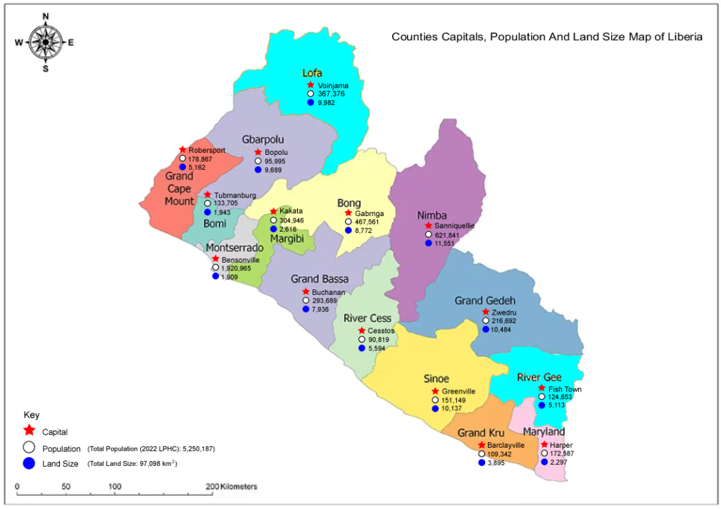
Counties Capitals, Population And Land Size Map of Liberia
Explore Liberia’s administrative landscape through an interactive map that highlights all 15 counties, their respective capitals, population figures, and land area. This visual resource offers a comprehensive overview of Liberia’s territorial structure, making it ideal for researchers, policy analysts, educators, and development planners.
Whether you’re studying regional demographics, comparing county sizes, or simply seeking a clearer understanding of Liberia’s governance framework, this map provides authoritative data in an accessible format.
What You’ll Find on This Page:
- A full map of Liberia segmented by county
- Capital cities of each county
- Latest population estimates
- Land size (in square kilometers) per county
- Visual comparisons and geographic insights
This page is part of LiberiaData’s growing Maps & Charts section, designed to make governance and district-level data more transparent and engaging.
source: liberiadata.com
Interactive Map:
Alternatively there is a very detail interactive map of the Republic of Liberia with each county clearly labeled, with hover-over details and clickable elements that reveal up-to-date statistics and geographic context.
Click to view the interactive map
Credit: citypopulation.de